
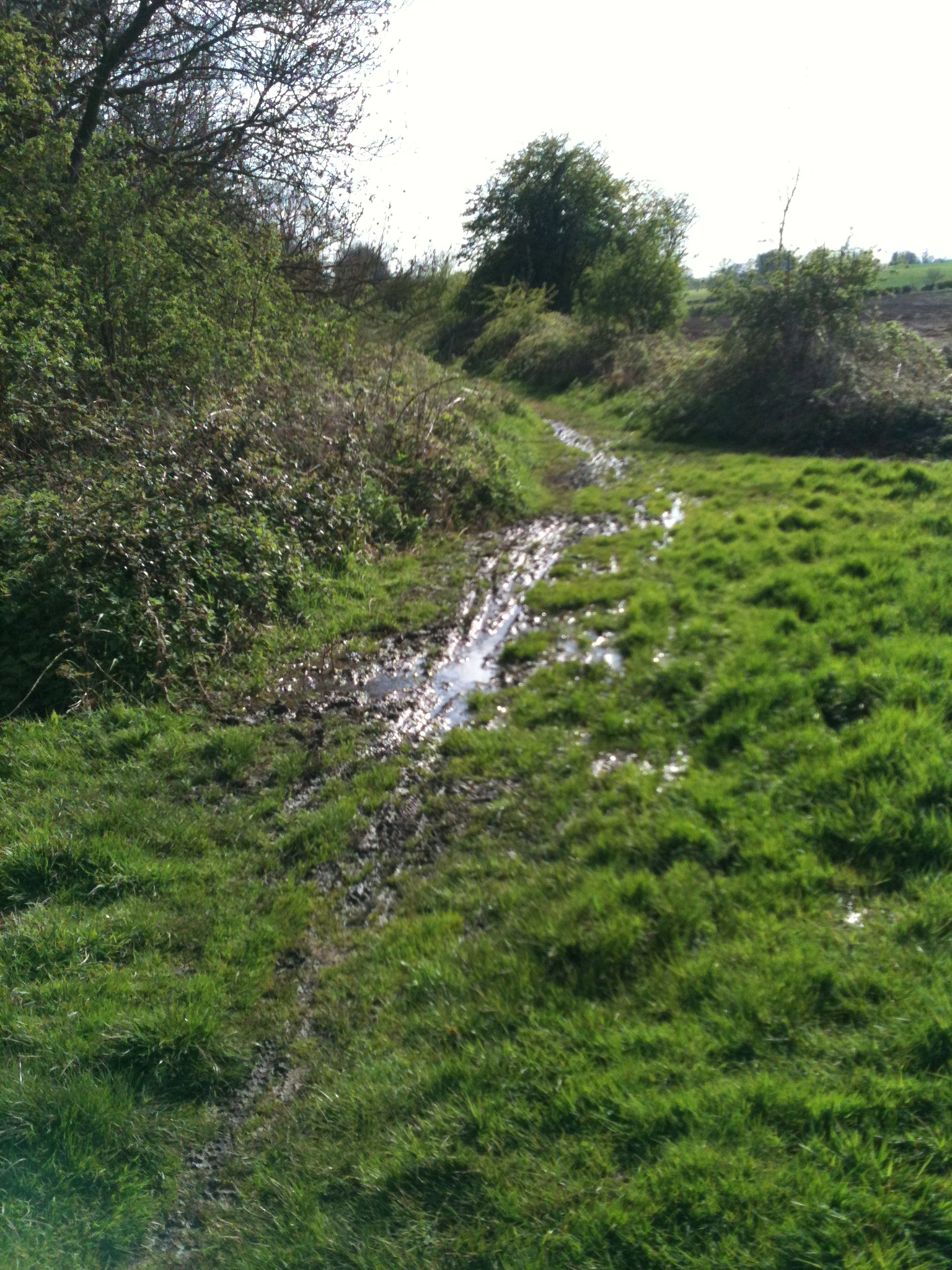
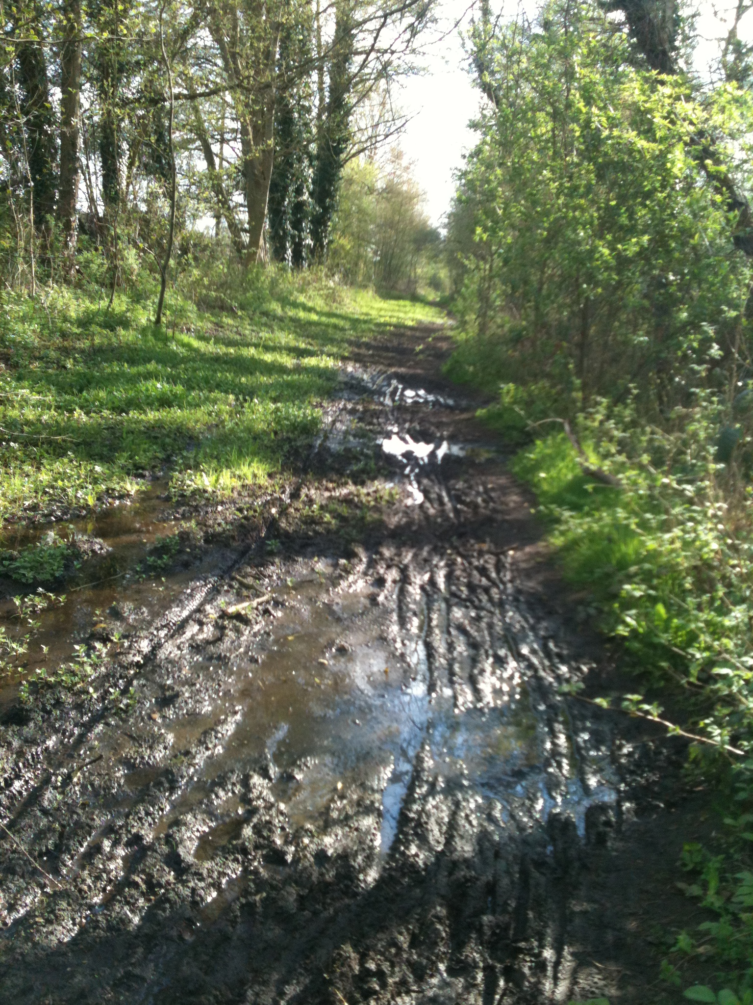
I am just putting up the pics of the flooded bit to see if anyone who sees them, has any ideas about how to tackle this bit.


 Thanks for looking and any ideas welcomed.
Paul
I am just putting up the pics of the flooded bit to see if anyone who sees them, has any ideas about how to tackle this bit.
Thanks for looking and any ideas welcomed.
Paul


Is it possible to determine from which side the water is draining onto this section, and then cut a channel on that side to divert the water off the centre section ? Also, do those drains which you have photographed possibly have a blockage which is causing water to back up and flood this area ?
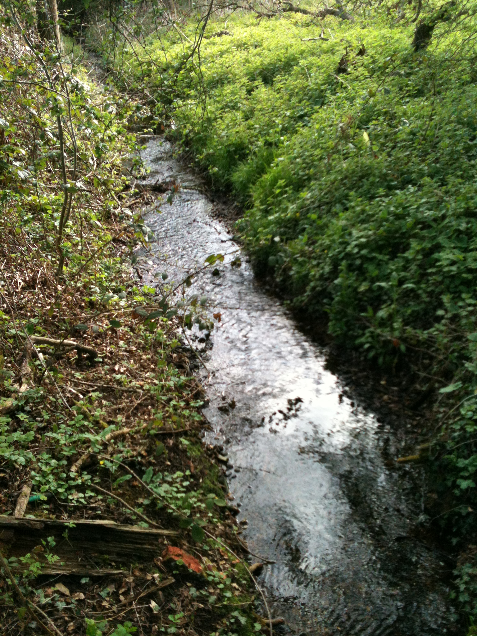
The drain takes the water out via the stream in the last picture. Maybe dig channels into the duct that feeds into that drain??
Hi Paul, I rode up the track today to have a look at two of the flooded sections. I’ve been riding or walking it for over 20 years now!
The one furthest from Draycote is caused by someone scooping out the hardcore to create a mound for motorcycle scrambling (now hidden). There has always been a pond/marsh on the N of the railway line around there. If the track level was raised and a ditch dug that would probably fix it.
The area close to where the footpath from the golf course crosses has always been damp in the winter, but used to dry up in the summer. However, it’s got a lot worse over the last 10 years. It would be easy to drain the water down the bank to the stream, but more difficult to find the source of the water. Personally, I think it’s draining from the golf course (which was created after the railway line closed).
The little wood opposite the golf course is lovely. It contains some fairly rare orchids and is well worth an explore.
The track has now been mowed from the far side of Draycote village to Birdingbury Station and looks a lot better for it. We had a village working party on the line last month, picked three bags of litter and cut some of the shrubs back.
Amazed at the progress you are making.
Well done
Pete